Imagery Products
21AT Asia’s satellite imagery are available with the following processing options:
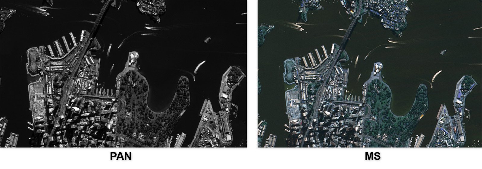
Level 1 (L1) - Raw Data Product
Sensor and radiometric corrected, without geo-rectification. Suitable for customers who wish to develop their own value-added imagery products. Comes with a bundle of 4 multi-spectral (MS) bands, panchromatic (PAN) band, and RPC.
Level 2 (L2A) – Ortho-ready Product
L1 product with additional map projection onto a plane. Comes with a bundle of 4 multi-spectral (MS) bands, panchromatic (PAN) band, and RPC.
Level 4 (L4) – Standard Ortho-rectification Product
Geometric corrected, ortho-rectified, and georeferenced on top of the L1 product, and the multi-spectral bands are pansharpened. L4 products come with either the standard RGB bands, or 4 bands (with the inclusion of the NIR band).
Level 4A (L4A) – Customized Ortho-rectification Product
Ortho-rectification process will be based on geo-referenced data provided by customer instead, with the similar option of 3- or 4-band bundles.
Imagery Data Processing
Ortho-rectification
Ortho-rectified Level 4 products are geometrically corrected using ground control points and Digital Elevation Models (DEM) to eliminate impacts on geometrical locations caused by undulating terrains. These imagery products are further processed to be projected onto specified earth ellipsoid surfaces.
Image Mosaic / Base Map
An on-demand regional coverage product made through assembling many smaller color-unified images at Level 4, can be produced according to the coverage and resolution as required by the customer. An ideal georeferenced imagery data for visualization, mapping, and planning purposes.
For examples of our base map examples, check out our case studies in our Publications page.

